
One of the first things, if not THE first thing, that one thinks of when they live in Colima or has heard of Colima is our volcano. Actually, there are three current volcanos in the CVC – Colima Volcanic Complex. The most obvious is the Volcán de Fuego, or Fire Volcano which sits on the border of Colima and Jalisco states. Further north is the Volcán Nevado, the inactive snow volcano. A third volcano, north of Nevado is El Cántaro, the existence of which I was unaware until I was researching the internet for this post. El Cántaro is the oldest, is inactive and eroded.
More than 38,500 years ago, the Paleofuego volcano began to form out of lava flows. This volcano collapsed at least 5 times, producing debris avalanches and pyroclastic-flow deposits. The last collapse happened 2505 years ago, producing a 5-km-wide caldera, inside of which grew the Colima Volcán de Fuego.
Throughout Colima you can see photographs and paintings of our Colima Volcano, businesses named after the volcano and tourism around Fuego and Nevada.


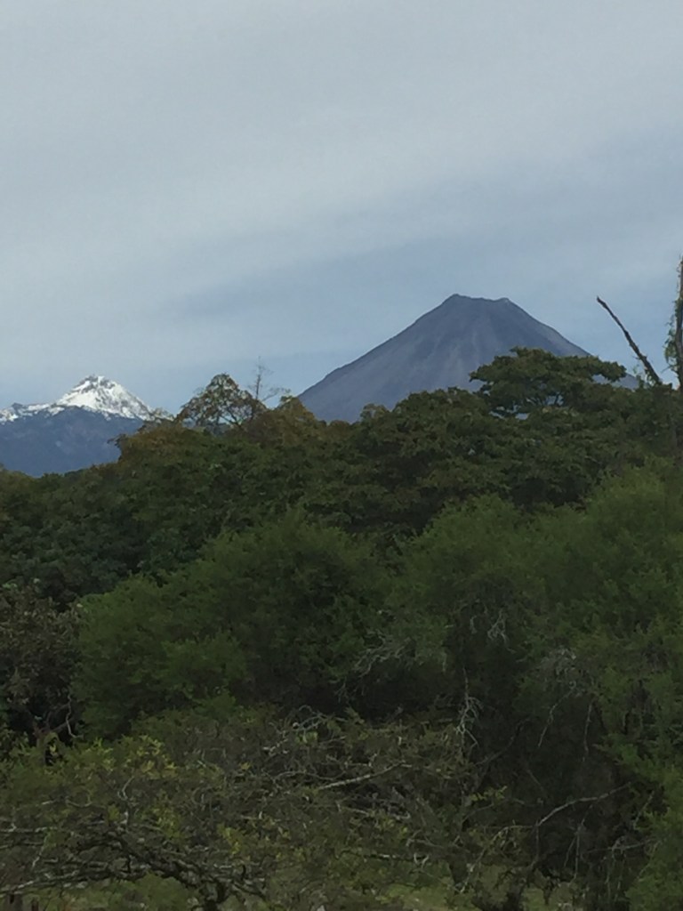
Here are a few views of Nevado and Fuego taken during various times of day and temperatures. Nevado is on the left and appears smaller than Fuego because it is farther away, but it is actually taller. We do not have snowfall here in Colima, but because of its height, Nevado does have snow when the temperature drops here. The coldest I have experienced here is around 50ºF (10ºC).
You can’t help but notice all the rocks within Colima State – cobblestone roads, rock walls, and a famous tourist attraction the Piedra Lisa, which translates to smooth rock. It is in a park in Colima, and legend is that if you slide down the Piedra, you will never leave Colima, or maybe you will return.
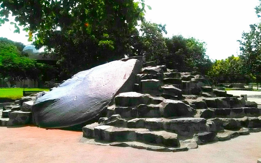
Photo of the Piedra Lisa

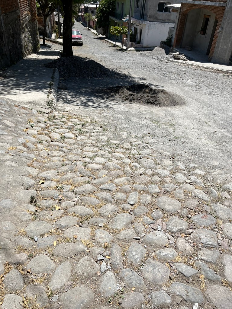
My driveway on the left and my street on the right. Some of the stones are obscured by gravel in the street being used for construction.
In the past, I’ve only thought about all these rocks in passing, but since I have started construction of a small guest house on my property, I have come face to face with the extent and enormity of these rocks and began to wonder about their origins. On Long Island, New York, where I grew up, we learned that Long Island was formed by glaciers pushing the rocks as they advanced. When the glaciers retreated, Long Island was left behind. I always hated how rocky the beaches were there, compared to the nice sandy beaches we would read about in the Caribbean, for instance.

One of the large rocks (boulders?) and a rock wall which illustrate the terrain of many parts of Colima.
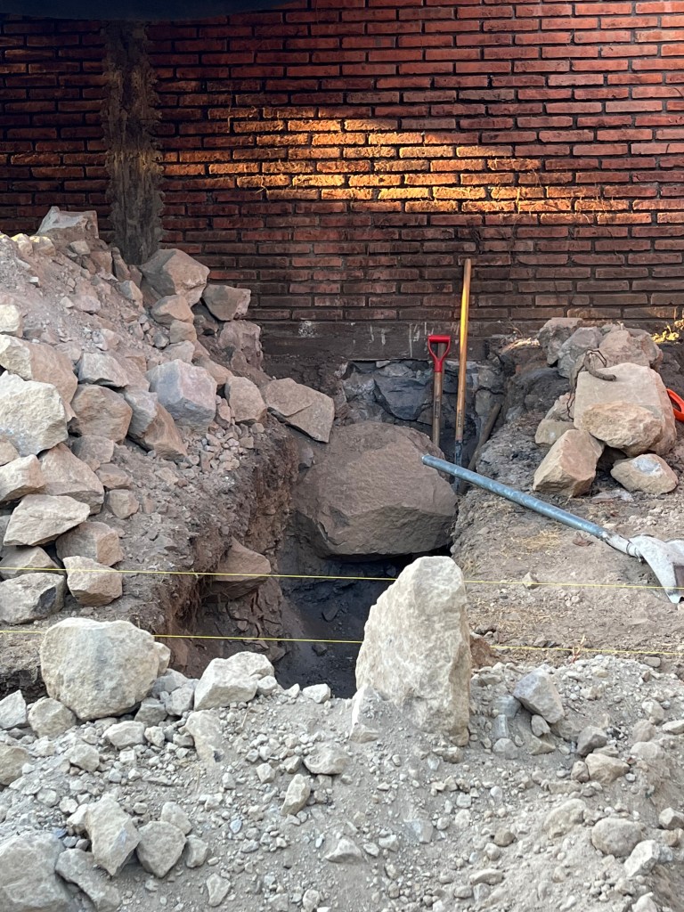
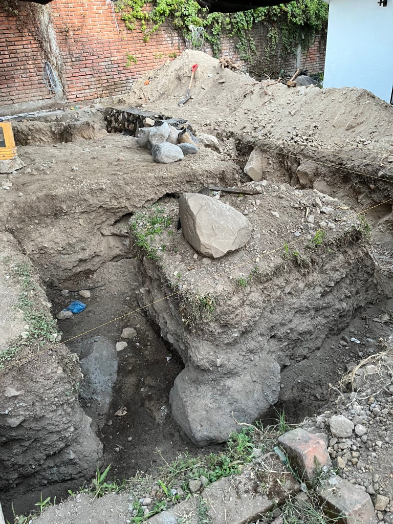
The first obstacle to the construction was a large, dense rock sticking up out of the ground which would block one side of the building if it was not moved. I had hoped that it was shallow underground and would be easy to move, but it turned out that, like an iceberg, 90% of its mass WAS underground. It was nearly impossible to move, a jackhammer did almost nothing to break it up, and it was decided that if the workers were unable to move it, we would need to blast it apart.
Actually, I was curious to see the blasting activity, having heard from my civil engineer father stories about having to blast things apart by drilling small holes, inserting the blasting material and then setting it off.
Anyway, they were able to construct and use a lever to move it out of the way, though they may have to move it a little further as the construction progresses.

As the foundation was being dug, there were even more rocks, but fortunately, we could use them as part of the foundation, leaving them in place and pouring cement around them.
Meanwhile, my search for the source of Colima’s geology continued. Now, I am not a geologist, so if anyone is more knowledgeable about this, please leave a comment.
It seems as if these conditions ARE a result of our Volcanic Complex. From debris flows to debris avalanches, to pyroclastic-flow deposits, as well as lahars, we are blessed with more rocks and boulders than we know what to do with. To clarify, a lahar is a destructive mudflow on the slopes of a volcano, which continues to happen to this day.
So right now that is about all I have to say about the geology of Colima. For me, when I see something curious, I love to research it to find out more and then share what I have discovered. It was also why I loved helping my son with his homework, even up through high school when he took courses such as geology. No one knows everything and there is always something new to learn, so we family members can learn alongside our younger members. Lifelong learning is a joy for me.
And so, I will conclude this post with a famous photograph of our Volcán de Fuego erupting with lightning bolts inside the ash cloud. We can all decide what climate conditions with which we prefer to live and no matter where you go, there are benefits and downsides – tornadoes, droughts, floods, heat, snow, etc. For me, I decided that I would rather deal with volcanoes and earthquakes than snow, ice and cold, and in the seven years I have been living here, I have never regretted it for a minute.


Wonderful!!! And interesting!! Thanks!!!
Susan Hill
Huizilacate #6
Cofradia de Suchitlan, CP 28460
Colima
Tel in Mexico: +52 312-395-4146
In USA:
302 Hannan Ranch Lane
Petaluma, CA 94952
LikeLike
Very interesting blog, Pat! Nice to know more about all these rocks around here…Thanks!
LikeLike